• Untitled Document

    The 2024-2025 Fund Raising Season has Opened!

    EricsonYachts.org has opened the season for raising funds to support the expenses of the site. If you would like to participate, please see the link below for additional information.

    Thanks so much for your continued support of EricsonYachts.org!

    2024-2025 Fund Raising Info

  • Untitled Document

    Join us on January 24th, 7pm EDT

    for the CBEC Virtual Meeting

    EY.o January Zoom Meeting

    All EYO members and followers are welcome to join the fun and get to know the people you've met online!

    See the link below for login credentials and join us!

    January Meeting Info

    (dismiss this notice by hitting 'X', upper right)

Paper chart plotting and navigation

DiamondDealer

Member II
When I was sailing as a live aboard we did have Loran and GPS was just coming in (intentionally gimped and of moderate usefulness) so we still used charts and old school tools to plot and Ded reckon. Does anyone do that anymore? I broke out some old charts, bought some new ones, found my plotting tools, and it's all come flooding back to me. In the meanwhile the young folk I know are pretty much just giggling and using their cell phones to bring up charts. (They stopped me from poking my dividers into the screen blast it!)

So am I the last of the dinosaurs, or does anyone else still plot and ded (deduced) reckon the old school way? I also still have a sextant and found how easy it is to get a nautical almanac, but can't get anyone interesting in learning. Math, y'know. Gawd forbid I use the word trigonometry!

I just wonder if I'm wasting my, and their, time trying to teach them how to navigate without electronics. Seems like trying to teach a driver to use a paper map when they've got siri right there
 
Last edited:

Frank Langer

1984 Ericson 30+, Nanaimo, BC
When I was sailing as a live aboard we did have Loran and GPS was just coming in (intentionally gimped and of moderate usefulness) so we still used charts and old school tools to plot and Ded reckon. Does anyone do that anymore? I broke out some old charts, bought some new ones, found my plotting tools, and it's all come flooding back to me. In the meanwhile the young folk I know are pretty much just giggling and using their cell phones to bring up charts. (They stopped me from poking my dividers into the screen blast it!)

So am I the last of the dinosaurs, or does anyone else still plot and ded (deduced) reckon the old school way? I also still have a sextant and found how easy it is to get a nautical almanac, but can't get anyone interesting in learning. Math, y'know. Gawd forbid I use the word trigonometry!

I just wonder if I'm wasting my, and their, time trying to teach them how to navigate without electronics. Seems like trying to teach a driver to use a paper map when they've got siri right there
Yes, the world is changing, but I think it's still important to know how to use paper charts in case the gps fails. Paper charts can also show large and small scale views that I find helpful, especially in trip planning. I know one can zoom in or out on the electronic stuff, but it's not as helpful to me as a good paper chart.
I do use electronic instruments, and no longer have the paper chart in the cockpit when underway, but I always have paper charts on board, and the tools to plot a course.
I have not, nor do I plan to, learn to use a sextant.
Frank
 

supersailor

Contributing Partner
I did the paper thing exclusively until 2012. I didn't trust the newfangled electronic stuff 'till then. I still plot position on a paper chart. If the whole electrical system crashes, it's nice to know your starting point. Besides, it's kind of fun.

Loren, I could get within 60 miles of my position with a sextant. Thank goodness for electronics.
 

Loren Beach

O34 - Portland, OR
Senior Moderator
Blogs Author
Like Bob, I do like to have the paper charts on board, even tho our late model Lowrance Plotter/Radar combo is certainly the bee's knees.
I recall using Loran on some 80's deliveries, and one time we even had a boat with a working SatNav on board... and using (at that time) the one remaining satellite still broadcasting we got a fix off the north Washington coast, having waiting for this since leaving Port Angeles. :)
Gratifying to see it work, but truly the 'end of an era'.

Do you remember the Loran glitch just off the Grays Harbor area? The transmitters would theoretically 'hand off' the signal and suddenly you'd find that your position had changed by many miles. IIRC we had to restart the Loran and then it would lock onto the next transmitter. A bit disconcerting if you'd not been warned to expect it.
Still, quite a miracle compared to Ye Olden Days! :)

Hey, anyone else recall the relatively poor reception of the old handheld Garmin 38? Couple of us each had one and had to stand on the stern quarter, holding the handheld unit up like the Statue of Liberty.... and then bring it down and read the Lat/Lon. One hand on the backstay and other to hold the receiver.
Awesome to pencil in our Exact Position on the paper chart! :D
 

Christian Williams

E381 - Los Angeles
Senior Moderator
Blogs Author
Chartplotters have relatively small screens and although you know exactly where you are on the water, situational awareness is dodgy. Classic case is Team Vestas hitting a reef at 20 knots because the navigator failed to zoom in on what appeared to be empty ocean.

So I carry large scale charts for planning approaches and harbors. And of course paper charts are works of art.
 

kapnkd

kapnkd
This navigation thread sure dusts off some cobwebs and stirs the memory banks!

My first attempt at offshore navigation was with my then new brand and model Catalina 22 going from Miami to Bimini. Winds were against us so decided a broad reach to West End, Grand Bahama was easier. (Yes! Not really to smart in such a small boat WAY offshore for such a distance!)

Affordable state of the art for me at that time was a borrowed portable RDF radio. One only had to find 3 radio towers to use their known location to triangulate your location from. The long rectangular antenna on your radio also had a compass dial so you could tune the null of the signal indicating the transmitter tower and then translate that to pencil lines on your chart. The triangulated area within the 3 signals was your approximate position. (In a rolling/bouncing 22’ boat, a 5 mile area was pretty darn good!)

Next cruise I had bought my own Pierce-Simpson RDF (quality brand back in the day) and thought I was on top of it all!

Later came the EXPENSIVE Lorans that you still had to interpolate the numbers to a Lat & Lon then chart it on paper to which dreams and wishes were for. Then! ...Apelco made a less costly but excellent unit that even provided the Lat & Lon! One still had to chart out the coordinates on your paper charts.

Loran worked great until their signals started paralleling and the accuracy went out the window as would happen in the FL Keys or Bahamas.

GPS has now certainly revolutionized the simplicity of navigation globally - but - I wonder how many today could confidently use a RDF or LORAN ...IF the GPS system went down for any sustained reason???
 

DiamondDealer

Member II
Gang, I loved reading your responses. It does my old heart good to see I'm not the only one who remembers, and still appreciates, the old arts. I'm actually a mid-west boy who learned land orienteering first and found that it translated well to nautical navigation. In spite of the fact that I once proved conclusively using my sextant and almanac that Dayton Ohio was square in the Bahamas, I still love using theory and observation to know where I am.
 

kapnkd

kapnkd
Gang, I loved reading your responses. It does my old heart good to see I'm not the only one who remembers, and still appreciates, the old arts. I'm actually a mid-west boy who learned land orienteering first and found that it translated well to nautical navigation. In spite of the fact that I once proved conclusively using my sextant and almanac that Dayton Ohio was square in the Bahamas, I still love using theory and observation to know where I am.

LOL!! ...Might not have been your sextant or calculated navigation!!

Remember, the Bahamas ARE smack dab in the Bermuda Triangle!! ;)
 

Tin Kicker

Sustaining Member
Moderator
After the Senator Stevens airplane accident near Dillingham Alaska, I was leading the small group to examine the wreckage and we had a GPS point near the top of a small mountain to climb to. A helicopter slowly flew us in under the scud till the sky met the ground and dropped us off on a clearing big enough for one skid. There was virtually no visibility near the base of the hills as he flew away and anybody who has been on a boat in fog understands.

Things got very very quiet in the middle of the Alaskan wilderness, there was lots of grizzly and brown bear scat around, and we had to go through most of a mile of the berry thickets they were feeding in. The hand-held Garmin RINO GPS said we were miles away from where we knew we were and it would skip around so was useless. We intentionally made lots of noise and did hear big things move away from us in the brush.
d72550ad-M.jpg

Found out later the GPS rubber duckie antenna broke and was making intermittent connections. In Garmin's defense, throwing packs out of a helicopter and working in the wild is very hard on equipment. The thing that saved our bacon was I had xeroxed the topo map for the area on waterproof paper because I've seen enough hand-velds and iPhones unable to navigate that I still believe in having paper as a back up.

kapnkid - I agree with your question but can't think of anybody who still has LORAN or RDF capability to begin with. Heck, nobody today learns to use a watch as a way to find North.
 

Loren Beach

O34 - Portland, OR
Senior Moderator
Blogs Author
Note that the Loran transmitters have been turned off, citing budget problems to try to maintain both Loran and GPS at the same time.
 

fool

Member III
Seems to me the number one rule of navigating on the high seas is often forgotten. How hard can it be to remember "don't hit anything"? To that end I'm all in favor of utilizing any and all recourses available. Aside from the usual senses, it seems a good plan to have both paper and electronics charts, and the knowledge to put them to use.

The USCG Aux offers a course that can be taken in a weekend and is recommended for the beginner and a refresher for the salty. Unsurprisingly it is titled Weekend Navigator.


Well worth the small fee, and you get to keep a nifty book too.
 

p.gazibara

Member III
We carried a bunch of paper charts when we first left WA, along with at least four separate digital devices with charts of the world loaded.

I have yet to plot a single point on a paper chart since I passed all those pesky tests for my USCG license. It’s been so much easier/safer/cheaper to embrace digital chartplotting/AIS.

OpenCPN is free and there is a USB with the charts of the world that is passed around then cruising community (also free). As a budget sailor, going digital really cuts back the price. We still record our lat/long every 4ish hrs in our logbook while underway, just in case.

Leaks slowly developed as we made our way across the Pacific. Those leaks found their way to our paper charts while Cindy was in Tahiti and we were back in the USA. We came back to a bunch of moldy charts. Out they went.

I still carry a large scale chart of the Pacific, a sextant, and a book on how to use it. I figure if all the digital stuff dies, I’ll have plenty of time to figure out where we are.

-P
 

Tin Kicker

Sustaining Member
Moderator
btw - On a related note with respect to trackers for location, I've had a couple of SPOTs and a couple of Garmin Inreaches. The SPOTs are inexpensive and good consumer grade for mild hikes but I've learned to not trust them. The Garmin Inreach series just plain work and I've been very happy with the Mini.
 

GrandpaSteve

Sustaining Member
On a submarine we always kept a DR plot going, along with the Gyro compass feeding a plotter with a chart overlay. The last time I did any paper chart work was when I took the Coast Guard Sailing and Seamanship class 15+ years ago. Iv'e never kept a plot on my boat on the Chesapeake, but I do refer to paper charts along with chart plotter at the wheel, and Navionics app on the phone.
 

Christian Williams

E381 - Los Angeles
Senior Moderator
Blogs Author
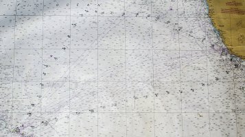
This is Chart 530 of the North Pacific. Interestingly, when I laid down a protractor to get the course home from any daily position, the course was entirely different from what the GPS chartplotter was so confidently telling me. That left a rather odd feeling of wondering exactly in which general direction North America actually lay.

I forget the reason for this, despite it being explained to me several times. The projection? Great Circle Route issues? Oh well, perhaps someone will explain it again. In any case, pilotage for 1,000 miles using a small scale chart doesn;t work. Just head east, like Columbus going home.

thelonious chart 2014.JPG
 

paul culver

Member III
The projection? Great Circle Route issues? Oh well, perhaps someone will explain it again. In any case, pilotage for 1,000 miles using a small scale chart doesn;t work. Just head east, like Columbus going home.
Interesting. Can you remember whether the disagreement was always in the same direction? Like maybe GPS further north than your protractor rhumb line?
 

DiamondDealer

Member II
Gang, I truly love reading your thoughts on these topics. That leads me to another couple: I've been thinking of doing a six-pack license not for commercial purposes but for the skill refresher. What do you all think?

And I'm curious about the rapid movement of magnetic north over the last few years. Has this affected your navigation a lot? How often do you check and adjust? Or do you even bother to with GPS? My sailing since the 90's has mostly been in known waters with easy ranges and markers (y'all know why it's called the Holy City, right?).
 

paul culver

Member III
Gang, I truly love reading your thoughts on these topics. That leads me to another couple: I've been thinking of doing a six-pack license not for commercial purposes but for the skill refresher. What do you all think?

And I'm curious about the rapid movement of magnetic north over the last few years. Has this affected your navigation a lot? How often do you check and adjust? Or do you even bother to with GPS? My sailing since the 90's has mostly been in known waters with easy ranges and markers (y'all know why it's called the Holy City, right?).
Magnetic north movement where I live (US west coast) is miniscule. What is it where you sail?
GPS receivers do have the ability to display true or magnetic courses so local variation can be factored in automatically.
And 6 pack licensing is admirable but short of that a solid course in coastal piloting is extremely valuable. They are offered by Coast Guard Auxillary and often at yacht clubs.
 

kiwisailor

Member III
Blogs Author
I have paper charts and guide books for all areas I sail in. I always check my paper charts when sailing in new areas to work out route plan and check for general hazards, markers, bouys etc to look out for. When out cruising I always have paper chart in cockpit just in case. My binnacle navpod has an older JRC 1800 CP radar chartplotter that I use as my back up secondary chartplotter. For my primary chartplotter I use a Samsung tablet with binnacle mount with OpenCPN charts installed and wifi linked back to my Vesper XB-8000 to obtain GPS and AIS information and to send waypoints to the NMEA 2000 connected autopilot.
 
Top